A highly classified US submarine drone, known as the ‘Manta Ray’, has recently drawn attention after eagle-eyed online observers identified it on Google Earth.
The drone was observed docked at the Port Hueneme naval base in California, and images of its presence quickly circulated on social media over the weekend.
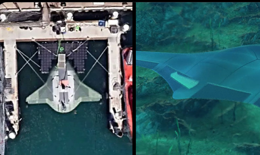
Despite some claims that the satellite images were altered or removed, current publicly accessible satellite views on Google Earth continue to display the vessel at its location.
Here it is:
Per The New York Post:
A top-secret US submarine prototype weapon called “Manta Ray” has been spotted by eagle-eyed Google Maps users and remains plainly visible to the internet public.
Satellite photos showing the “Star Wars”-looking vessel docked at Port Hueneme naval base in California went viral Sunday, its unmistakable profile standing out in stark contrast to its dockmates.
The smooth-looking autonomous vessel was named after the sea creature for its slick design and its ability to anchor itself deep underwater while operating in low-power mode.
Produced by Northrop Grumman as part of a US Navy project to develop long-range underwater weapons, Manta Ray is a sophisticated underwater drone capable of hibernating on the sea floor for “very long periods” without refueling.